

Title: June 14, 2022 - Buena Vista Peak
Hike Info : Description : Extra Photo's : Flowers and Plants
Type: Hiking
Trail head: Buena Vista Parking Area
Trail: Buena Vista Peak
Destination: Buena Vista Peak
Distance: 2.11 miles
Start Time: 12:43
End Time: 3:19
Travel Time: 2:36 (0.81 mph)

Moving Time: 1:49 (1.16 mph)
Elevation Rise: 545
Descent: 561‘
Maximum Elevation: 7,628'
Sherri has been having some foot problems lately. Her chiropractor is working on it and has suggested she needed to exercise a bit more. So we will go on a short hike, but not sure where.
 |
| Gary on the trail |
So we drove on to the Buena Vista Trailhead. We find a group of seniors congregating, talking about what they are going to do. Not sure there is much to decide from here. They leave and about 15 minutes later we are ready to go.
The trail is well known to us. I am wearing a 28 pound backpack-mostly ballast--to help in training for a coming up backpack trip. Legs are good, but the lungs need to get better. On the other hand, Sherri’s foot is bothering her. She takes it easy on the way up. This will get her to the top.
 |
| Burnt Spots |
We can see how the KNP Complex Fire from the Fall of 2021 hit the east side of the Peak. But it looks more like pockets of fire torched the trees and plants on this side rather than complete devasation. It is mostly green, so the hike is not dreary. But the burnt spots are a reminder of what the fire wrecked.

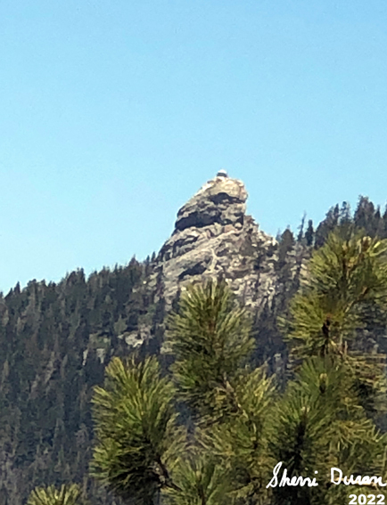
Park Ridge Lookout
A note is that the wildflowers
are out. Colors galore. We see the violets of lupine and penstemon.
The yellow western wallflowers sprout all over the place, like
spikes of color among a tract of green. Then there are the pinks and
whites of misc types of flowers. Bits of color to contrast with the
browns and blacks of a somewhat burnt forest.
We make the ridge which leads up to the peak’s top. We have met several of the senior group going down and some people who passed us going up came back down as well. So by the time we reach the top, we are up there alone. That is fine with me.
Looking around, the first
thing we notice is the desolation of the KNP fire. The sides of the
Big
Baldy
ridge are all scorched. Then looking up at Redwood Mountain, the
west half of the mountain is decimated along with what is below it.
Surprisingly the upper part of Redwood
Canyon
looks untouched, at least from our perch above. Now we look towards
Park Ridge and see nothing but burnt trees. All of this gives me
pause and just a sense of awe. I can have a bit of understanding of
what Habakkuk had when he saw how Israel was to be destroyed:
Park Ridge
and station myself on the ramparts;
I will look to see what he will say to me,
and what answer I am to give to this complaint.

Smoke from the Hazelwood-Tharp Prescribed Burn
The answer will be a time
a-coming. Why does destruction happen? Maybe a glimpse of the answer
can be found in the wildflowers. We do not see the works of God until
they are taken away. And then we cry about the destruction of it. The
wildflowers are a reminder that God will not let the evil of
destruction be permanent, but will bring life and goodness from it.
From this point, we look around for our lookouts. Delilah is behind a ridge. Buck Rock has been standing proudly on top of its rock. Later I sent an email saying I am watching the lookout from our peak. She does not get it until much later. And then there is Park Ridge. Usually we can see where the lookout should be, but only vaguely see the lookout from the trees surrounding it. Today, the trees are burnt away and we now see it pretty plainly.

A ridge's trees decimated
After eating lunch, we start
our way down. Now going down has never been Sherri’s strong suit.
But with the additional pressure on her foot, it really is bothering
her. So we take it pretty slow. More time going down than up. But we
make it down safely, just a bit painfully on Sherri’s part. It
gives her something to think about if she will enjoy going
backpacking next week. On the other hand, I did better than what I
thought I would with the additional weight on my back.
Sherri beside a burnt stump
There are some questions we have, not about today. But about hikes we want to do, such as a need for a permit in the Jennie Lake Wilderness-the answer is no. We had a good conversation with the Forest Service ranger, Randy. Yes a Forest Service Ranger was there to answer questions about the Forest and other things.
As we are leaving, we see a hiking friend of ours, Alan. We talk for a while, comparing notes about how things are going since we last saw each other. Then we are off with me driving. We get home right around 4:30. We are both happy to have gone, but know that we have a ways to go before we are up to being in a good condition.
 |
| Sherri on the climb |
 |
| Gary |
 |
| Big Baldy and Redwood Canyon |
 |
| Smoke from the Hazelwood-Tharp Prescribed Burn |
 |
| Smoke from the Hazelwood-Tharp Prescribed Burn |
 |
| Looking north with the Obelisk Mt Goddard and many others |
 |
| Buck Rock |
Flowers and Plants


No comments:
Post a Comment