Monday, November 23, 2020

November 23, 2020 - South Wilderness Trail


Title: November 23, 2020 - South Wilderness Trail
Hike Info : Description : Trail Lessons : Background : Extra Photo's : Animals : Flowers and Plants


Trail head:  Pinnacles Campground
Hike Info:
Type: Hiking
Trail: Bench and South Wilderness Trails
Destination:  End of Trail
Distance:  6.48 miles
Start Time: 9:35
End Time:  2:33
Travel Time:  4:58 (1.30 mph)
Moving Time:  3:25 (1.90 mph)
Elevation Rise:  601'
Descent: 543‘
Maximum Elevation: 1,010'

GPS Tracks

Description:

I got up at 6:45. There is light in the sky, but the sun has not reached us yet. And yes, it is pretty cold. The water has not frozen, but I am glad there are gloves on my hands. Also the mask to protect against COVID-19 has the dual function of being a nose warmer. Last night I woke up pretty cold. Adding my wool socks to my feet helped a lot.

Andrea got up shortly after I did. We made pancakes and bacon-a good cold morning breakfast. Tea and Tang supplement our meal. We are able to observe our surroundings a lot more than last night. We notice the coloring of the broadleaf leaves. By the time we got cleaned up and ready. By 9:30 or so, we were on the trail.

Start of Bench Trail

When I first thought about doing the South Wilderness Trail, I was thinking more in terms of a nice little hike with a low probability of anything really attractive. The reports I read said that it was a no-maintenance trail running through a creekbed. So the bar was low. I was wrong.

Today, we will be going down the Bench Trail for half a mile, then doing the South Wilderness Trail. The Bench Trail starts at the end of the road we are camped on-how convenient that is for us. The first half a mile is pretty level and broad. Andrea and I walk side by side, with masks on for the most part. We get to appreciate the fall colors surrounding us. But this jaunt will only get us prepared for more.


Andrea observing the color

Once on the South Wilderness Trail, it really is a service road for the first third of a mile. We see a sign saying Service Road. Just to the right of that is our trail. It shortly crosses the dry Chalone Creek. There are some sticks in the bottom of it to aid the hiker crossing this. But if that is all the aid needed, then Chalone Creek is not much of an obstacle.

For the rest of our trek, we travel either on the west side of Chalone Creek, or in the Creek-it was dry-I wonder how the trail is if the creek is running? The trail in places is narrow, on a steep slope of dirt, but in most places it is wide enough to scoot off for someone to pass us by-going out there was no need as we were the sole travelers. It seems like the trail goes up and down with more up on the way south. But looking at the contour map, it looks like we are heading downstream. Coming back, we verify this. We eventually get to the boundary of the park and private land. A fence runs along this and the trail turns into a path going along the fence. I suspect most people stop here, but we continue on till we reach a gully. It would be simple to cross the gully, but then there is a steep uphill with less of a path, so we stop here.

Andrea hiking down the creek bed


Let me backtrack here. I have already alluded to that there were Fall colors around. But as we go up the South Wilderness Trail, it is a constant parade. Yellows and gold are matched with dull greens of pines. The grasses has turned the color of straw. But berry plants had dark reds and greens, along with an abundance of thorns which seemed to claw at us. This whole scene continued on our way to the Pinnacles southern boundary. It makes for delightful walking-at least it provides for a constant excuse to stop and take a picture.

Boundary fence where we ate lunch
Back to the trail. When we get back to the edge of the boundary, we stop for lunch. A pleasant enough place. Andrea and I do a lot of talking over these several days together. When we get ready to leave, Andrea discovers two things: first, some of the berry plants have snagged her leggings. Guess Sherri will have a task for her. Second, where we sat, there was pine pitch mixed in the grass.


Pathway to Color


Going back, we recognize the slight uphill the topo map indicated, but not enough to really hamper me-I normally would say us, but Andrea is unstoppable, except to wait for her Dad. Going back we observe the same things we did going in, but from a different angle. It is amazing the difference in seeing things backwards makes. You know how I said we did not meet anybody coming up? We meet several different groups of people. First a family which seemed like they had been up that way before. Then a pretty discourteous couple who insisted on passing us, one without a mask, on a narrow section of trail. I guess they must have been in a hurry thinking the Fall colors would not last until they got there. Three boys-really in their 20’s, who seemed lost right at the start of the trail. The next lady turned them around. We talked with her for a time-enjoyable talking.

Chain-link Building
 

In our travels, we spot a chain-linked cage without a top, but with a gate. Beside it is what looks like an old lock box, at least it has a NPS lock on it. Even more puzzling is the little tag on the cage saying “This is a Building” with the note that there are fines associated with disturbing it. I would really hate to be caught in that building during a rainstorm.


Condors


We make it back to camp around 2:30. I am feeling pretty good about myself. We rest up for an hour or so, reading and the like. As cold as it was this morning, it is pleasant this afternoon. Pleasant enough that I am in a T-Shirt, but not for long. Once the shadows reach us, it is time to put on longer sleeved clothing.

This morning, I realized that among things I did not bring besides much of the plastic ware were eggs for tomorrow’s french toast. Off to the store we go, my legs still feel decent enough after our hike from this morning. Safety precautions are in place at the store where only two people are allowed in at a time. Andrea, in protection mode for her father, goes in and decides we really do not need eggs that badly. On the way back, we stop to look at some permanently mounted spotting scopes. A man is looking up at the sky. He says condors. Sure enough there are half a dozen of them circling around above us. Wonders never cease.

Dinner is a lookout special: gnocchi with marinara and cheese sauce. Easy and good tasting. Afterwards we lit the heater Sherri bought. We are trying it out to see how it works in a cold weather situation. It does good. We have a second heater, but it does not get past its pilot light. Still it is warm enough for us to talk a bit. At least until a little after 7:00 when we both decide it is getting cold enough we want to retreat to the comfort of our tents. I read for a bit longer, probably a bit after 8:00 before dozing off. A good day with my daughter.


Trail Lesson:

Sort of like life, just because a trail looks ordinary, does not mean that it cannot be extraordinary.


Background

South Wilderness Trail. After discovering this trail on the map, I did what any good geek would do: look for information on it. I came across a blog called Live and Let Hike which had information on the trail. Good description, just not for the Fall.


Extra Photo's


Animals

High flying condor


Flowers and Plants

Buckwheat, I think


Sage


Sunday, November 22, 2020

November 22, 2020 - Pinnacles


Title: November 22, 2020 - Pinnacles
Hike Info : Description
    
Hike Info:
Type: Car

Description:

I woke up about my usual time. Went for a short walk and then had breakfast. I got things packed, but it is unknown at this point if one or two of us are going from Fresno. Sherri hurt her ankle Friday and is unsure if she should go. She will have a video conference with a doctor in a couple of hours.

In the meantime, we watch church from First Presbyterian on YouTube. Jeremy has gotten a new dimension to him since the beginning of Summer. After church, I shower and get the last of the preparations ready to go to the Pinnacles.

The doctor is a little early, which is good. He thinks it is a sprain. He suggests she be off of her feet for a couple of days. I ask about camping. He does not think this is a good idea. So this takes care of the question of how many people are going.

I get prepared, loading the truck with equipment. Sherri gets the food prepared. By the time all of this happens, it is 1:15 before I am ready to leave. I said my goodbyes to Sherri and Steven and then took off. Feels rather funny not having Sherri along with me.

I get to the Pinnacles around 4:00pm. The first stop is at the store/park visitor center. A pretty good line. But talking to a docent, she says that since I already know my campsite number no need to register. So I go directly to it, 129, a group campsite.

It is amazing about how much stuff I brought just for myself, and food for Andrea. Definitely more stuff than I take to lookout for four days. I was able to unload and get the dining area pretty much set up before Andrea came. We set up our separate tents and put in our sleeping arrangements. Because we are from separate households, we are sleeping separately-I am not sure if we would have slept in the same tent anyway.

It is starting to get dark, so we break open the ice chest-which in this case is a warming area-and out comes the beerocks which Sherri heated up. Tasted pretty good, still nice and warm.

We got out the heaters Sherri bought. The one we tried out before worked pretty well.. There is a cool breeze which blows the heat more Andrea’s way than mine. Still I feel a little bit of it. Andrea has some hot tea, I have some hot chocolate. The one right out of the box, only the pilot light works, not the heater. Will try again tomorrow night.

After talking a bit, we decide it is getting too cold to stay out, so off to our sleeping areas. So good to be with Andrea, relaxing with her. Even inside the tent it is cold. I quickly get into my bag, after putting in a liner. It was still cold enough I was not holding my iPad steady enough to read it. So after trying for a little while, I succumb both to failure and sleep.

Thursday, November 5, 2020

November 5, 2020 - Giant Forest


Title: November 5, 2020 - Giant Forest
Hike Info : Description : Background : Extra Photo's : Flowers and Plants
Hike Info:
Type: Hiking
Trail: Rimrock (Moro Rock), Soldier’s, Bear Hill Trails

Destination:  Loop
Distance:  3.81 miles 1Start Time:  9:51
End Time:   2:09  
Travel Time:  4:18 (0.89 mph)
Moving Time:  3:18 (1.15 mph)
Elevation Rise:  1,024'
Descent: 571‘
Maximum Elevation: 6,807' 
GPS Tracks
 1For about .2 of a mile, the GPS was not syncing with satellites, I plotted it out on Google Earth for the distance.
 
 Description:

Start of Rimrock/Moro Rock Trail

We gather at our house, a little after 7am. The “we” are Rose, John, Cathey, Sherri and myself. It is the first time hiking with John and Cathey in over 8 months. With the pandemic, Sherri and I are particular about who we walk with. Each of these people are people whom we think will take the appropriate precautions against the COVID virus.

We go up Highway 180 and have no issues entering the park. Along the General’s Highway, we know there is construction. Surprisingly, we hit the various spots so we have a minimal amount of wait. At one of them, we come to a stop, the flagger asks where we are going. I say Giant Forest and the next two cars are going there as well. He ponders for a few seconds, calls up the flagger at the other end. He says to me, “You are the lead car, be safe. There are people walking the road.” I guess I must have that look about me.

Autumn Color


We get to Giant Forest after 9am. Getting unloaded and booted up, we take off for that place which all hikers know to start with: the restrooms. So the trail gets hit a bit after 9:30.

The trail starts just to the south of the road going into Crescent Meadows. Even though a large sign says Moro Rock Trail, I know it as the Rimrock Trail. Why? It goes along the south side, heading towards Moro Rock, sometimes you even get to see a view or two of the Kaweah River Canyon.

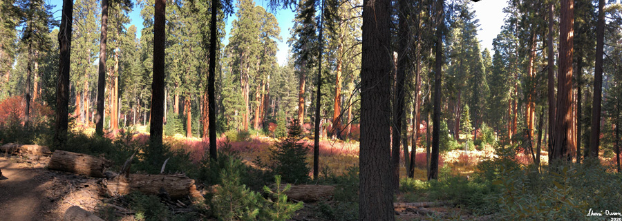
After about fifteen minutes of walking, there is what looks like a full out display of fall colors. But this is just a prelude of what we are to see coming up the trail. There is no point of trying to put the scenes to words, especially my pitiful ways of expressing the glory of Creation. Maybe if I was a musician, I would be writing a symphony, an ode to beauty. All which you will have to be content with, dear reader, is pictures.

Rose being swallowed by a tree

We go along this first trail, content with enjoying the colors. Rose and I play a game of naming the burnt stumps by how they appear to us. While the Sequoias have been around us from the beginning, they are more prevalent as we make our way to the Moro Rock area. While we are close to the road into Crescent Meadow, the traffic is light enough and the road is at such an angle, we are not bothered by it.

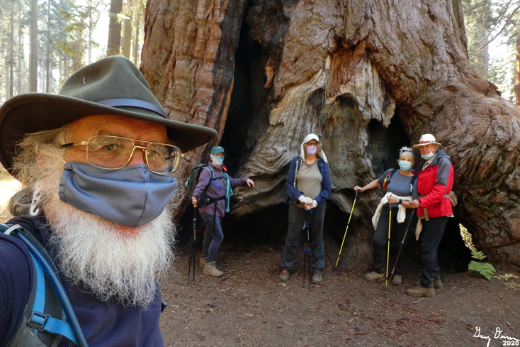
We reach the end of the trail, at least as far as we are going to do. The trail goes on to Moro Rock, but we have other places we want to go. We walk the road for a ways. There is a fallen tree with a gigantic-aren’t all Sequoia’s gigantic? And then there is the Parker Group. We hang around there for a few minutes. Rose pushes apart a couple trees. And then we meet the Ives tree, at least that is what I call it. The Ives tree has a huge burl-think about it. And then it is on to the tunnel tree. But we do not go quite that far. For we meet up with the Soldier Trail.

"Ives" Tree with the Burl


To me, this is the heart of the heart. The colors are more varied and intense. The surrounding Sequoias reddish hues blend nicely with the Autumn coloring of the seasonal trees and bushes. And then there are the shapes which offset the roundness of the bushes and the low trees. Upended tree roots with a spray of color at the end; a wall of chromatic plants surround columns of red bark; open glades are surrounded by dirt and spots of purple, reds, and yellows.

There is a gentle rise to start the trail. But then we climb a ridge which will eventually lead us into the Little Deer Creek drainage. We lose much of the brush and foliage and enter into an area where fire has burnt through-I think this was a prescribed burn from a couple of years ago. We pass by a burnt tree which is called the Burnt Arrow. When we reach the top, it is time to break out lunch. Very considerate of the Park to have a couple of logs cut there-the stumps make for a nice place to sit.

Roots and Color


And now it is about 80% downhill for the rest of the trip. I am not sure if it is because of the rest or being downhill, I am feeling a lot better, The first part is rather steep. The Sequoias still accompany us. All is quiet, we still have not met anybody on our trek, except when we walked the road. That seems so appropriate as a Sequoia forest should be experienced in peace, letting the stately old ones fill your heart.

As we go down, we return to more of the shrubs and leafed trees, and back to the colors again. There is a section where the trail looks like it disappears into this cataclysm of color-it only does a switchback, still an exciting visual. As we progress down, we see another trail. That is the one we will take to Bear Hill.

Burnt Tree


From this junction, it is an uphill climb, of over a hundred feet. While it does not sound bad, and really is not bad, it takes a bit out of me. Still, I feel so much better than I have on past hikes. Still, the beauty of the Fall is refreshing. At the top of the hill, another trail junction greets us. But I tell the group that I am going about 50 yards further. That is to
Bear Hill. All which really remains of the old Bear Hill is a wide space on the trail and a weather station. We inspect the station and wonder about a wire mesh laying on the ground. Unknown what this is about.

And now for the final stretch, which I am sure you readers will appreciate. We descend a long stretch towards the General’s Highway. Evening shadows have long overtaken us, even though it is still mid afternoon. This also darkens the Fall colors, even a different hue to the vision of the area. As we approach a fallen tree which has a tunnel carved out for hikers, we come across the first hikers of the day. While we are a ways off, they slip on their masks and we have a conversation about what is up the trail for them.

Cathey, Sherri, Rose and John

A couple hundred more yards and we hit a paved path which parallels the highway. We head left and in five minutes time we are back at the museum. All of make a pit stop before heading up to the cars.

We talk about what to do next. There is the Beetle Rock area, but everybody are done with hiking today. SO off we go. But we do stop to pick up pizza at Bear Mountain Pizza in Squaw Valley. It has been a year since we ate there. We have our meal on a grassy area with picnic tables. Good conversation before we all head home.


Background

Soldier’s Trail. The trail was created by the men under Colonel Charles Young command. They had built the road from Crystal Cave up to Giant Forest. The trail was named after these Buffalo Soldiers both because they built the trail and the road, but also because they secured the area, keeping in mind the dual mission of preserving the area and making it accessible for recreation.

  Extra Photo's


Gary and Rose


On the wire mesh at Bear Hill-John, Gary and Cathey


John


Cathey


Rose and Cathey disappearing into the Autumn colors


Burnt Arrow


Tunnel Log, right before we turn off on the Soldier Trail

Gary and Rose on the road, again

The Burl on Ives


Cathey at the Parker Group of Sequoias


Cathey, John, Rose and Sherri


  Flowers and Plants

Last Columbine of the season