
Title: Sept 17, 2021 - Day Eleven-Craters of the Moon to Ontario
Hike Info : Description : Extra Photo's : Flowers and Plants


Trail head: Inferno Cone parking area
Type: Hiking : Car
Trail: Inferno Cone Trail
Destination: Inferno Cone
Distance: 0.37 miles 1
Elevation Rise: 145 '
Descent: 149‘
Maximum Elevation: 6,161'


Trail head: Indian Caves parking area
Type: Hiking
Trail: Indian Caves Trail
Destination: Indian Caves
Distance: 1.17 miles 1
Elevation Rise: 116'
Descent: 114‘
Maximum Elevation: 5,788'
Mileage: 264 miles

 |
| Craters of the Moon Entrance |
 |
| Lava Fields looking towards Craters |
I was the first one up at 7am. Lawrence needs to make a dash, as much as you can dash with a teardrop trailer being towed by a Subaru. He needs to go on a more direct route to the Bay Area. So we are taking Andrea to Bend. Consequently, I am rearranging our car to take on her gear as well as her person. We should be able to do this.
Yesterday I talked about the scrub plants in the Boondoggle area. Well they got us. They have these goat-head like sticker thingys. Well one or more must have gotten into the tent. Sherri’s mattress was definitely less comfortable last night than the rest of the trip. It had deflated some-not completely but enough that the princess could feel the pea-sized rock underneath.
 |
| Inferno Cone |
Lawrence makes us scrambled eggs, bacon and toast. I cannot say the broccoli and mushroom is appreciated by me, but it is by everyone else. I guess that is the price to be paid for being someone of limited tastes. I feel though that we all have bent to each other’s desires and tried to be accommodating-at least that is how I feel I have been treated.
 |
| Gary looking south on top of Inferno Cone |
 |
| Looking South |
When we enter the main part of the park, we first look at the campground. This would have been entirely suitable. Of course, we would have had to eat before coming. Also there is little or very sporadic Internet connectivity here. So it was probably best to have stayed in Arco. That is, except for that thorny issue we encountered. Andrea gets a text from Lawrence. He realized that he would be passing right by the Craters of the Moon before he heads out. So we went back out and met him.
 |
| Andrea and Lawrence |
 |
| Inferno Cone Tree |
Like Sentinel Dome, there is a tree standing there, defying the elements and the sun. Unlike the Sentinel Tree this one does not look worn. When we come down, we drive a little ways to the Spatter Cones and Snow Cone parking area. Here we have lunch. There are a couple formations which look interesting and has trails to them. They exhibit the formation of lava in these parts.We take the short walk to them. In some ways, they are non-descript. But they do show how these cones have a hole in the middle. There is a sign saying the reason why we cannot climb on these cones is that they have lost several inches of height due to people climbing and crawling over them.
 |
| Spatter Cone Interior |
We find the Indian Tunnel and descend into its cavity. There are rock steps down. Towards the bottom, my toe catches a rock and I come close to tripping, rising concerns momentarily apprehension ny those who accompany me. The cavern which this lava tube must have been immense before the roof fell in. But this lets daylight to flood the tunnel and we hardly need a light except for a few places. This means the floor of the cavern is littered with boulders. We pick our way around these and walk the length of it. At the end of the tunnel, we climb out onto the lavel bed. There are steel poles marking a return route to the start of the tunnel. I am not sure I would be able to find my way without them. Everything is a series of lava bumps.
 |
| Indian Tunnel |
 |
| Gary climbing out of Tunnel |
There are two questions which we have as we approach Boise. First, where to stay. But evidently there is a Boise State football game and rooms are tight. So this does not sound promising. But Sherri and Andrea find a place down the road in Ontario, OR. The second question is where to have dinner-we are getting a bit hungry. Our friend Fritz went too Boise so we messaged him. He recommends the Idaho Pizza Company. We find out there are several in Boise, but we pick one about a mile off the Interstate on Broadway.
 |
| Lava Stretching on forever |
 |
| Pizza |
 |
| Bread sticks |
We were a little bummed when we got there. It looked like they had outdoor seating. But they no longer do. But we saw a room off to the side which we could be isolated in-Idaho is one of those low vaccination/high COVID infection states. So we decided to chance it. Both the bread sticks and pizza were great, hitting home. We filled up and were content.
With that we hit the road again for another hour up to Ontatrio in Oregon, right over the border from Idaho. We hit the Quality Inn there. They had a room for us. We got into the room and were able to relax, then fall asleep quickly.

Extra Photo's
 |
| Sherri and Andrea |
 |
| People on top of Inferno Cone |
 |
| Spatter and Snow Cone |
 |
| From the top of Inferno Cone looking south |
 |
| Andrea, Lawrence, Sherri and Gary on top of Inferno Cone |
 |
| Tree on top of Inferno Cone |
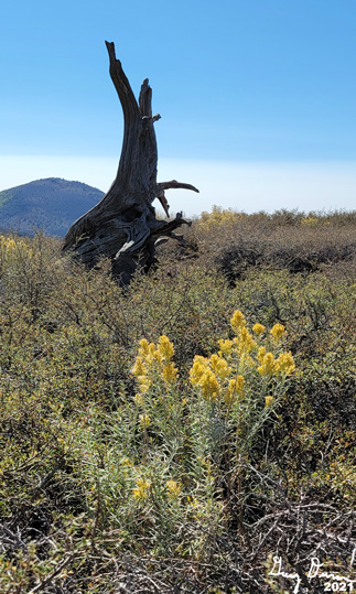 |
| Stump and Flower on top of Inferno Cone |
 |
| Snow Cone |
 |
| Side wall of Indian Tunnel |
 |
| Gary and Sherri in Indian Tunnel |
 |
| Andrea and Gary Walking to Indian Tunnel |
 |
| Sherri exiting Indian Tunnel |
 |
| Gary exiting Indian Tunnel |
Flowers and Plants


No comments:
Post a Comment